
WHEN: December 8, 2012
WHERE: South of Broad (Charleston, SC)
Here is Part 2 of my tour of Charleston's South Of Broad district...a "year late"!
Part 1 can be seen here.
You can also find out more info about and see pictures of each house by clicking on different districts on the Charleston County Public Library's Historic District's page.
Part 1 can be seen here.
You can also find out more info about and see pictures of each house by clicking on different districts on the Charleston County Public Library's Historic District's page.

39 East Battery St. (c. 1810)

41 East Bay St.

45 East Bay St. (c. 1780)

Stoll's Alley, possible the narrowest road in downtown Charleston

Stoll's Alley
This is an actual street with houses and addresses, which can be seen farther down in this post.
This is an actual street with houses and addresses, which can be seen farther down in this post.

47 East Bay St. (c. 1740) - Mrs. Boone's House

Driveway at 47 East Bay St.

51 East Bay St. (c. 1800)

Plaque on the wall outside the house

Plaque on the wall outside the house

The house at 53 East Bay St. (c. 1780) is home to the Charleston Club, founded in 1852.

55 East Bay St. (c. 1780) - Jonathan Simpson House

Window planters outside the house.
I took plenty of window planter pictures this day. They are a staple of house decor in downtown, particularly beautiful when it's December.
I took plenty of window planter pictures this day. They are a staple of house decor in downtown, particularly beautiful when it's December.

57 East Bay St. (c. 1783) - Thomas Pinckney House

59 East Bay St.

Gate at 59 East Bay St.

63 East Bay St.

Front door at 63 East Bay St.

This history of the plot of land at 63 East Bay St.

East Bay St. street marker

Longitude Lane street marker

A (rare) empty sidewalk in front of Rainbow Row

A (rare) empty sidewalk in front of Rainbow Row

Rainbow Row is the most iconic image representing Charleston. Stretching 4 city blocks, these houses were built between the 1720s-1790s and represent the longest stretch of Georgian row houses in the US.

Plaque on 93 East Bay St., detailing the history of Rainbow Row

Plaque on 93 East Bay St., detailing the history of Rainbow Row

93 East Bay St. (c. 1778)

Window planters at 93 East Bay St.

99-101 East Bay St. (c. 1740)

Plaque on the wall outside 99-101 East Bay St.


109 East Bay St. (c. 1909)
Converted to residential condos in 1983, this building was built as the printing building for Walker, Evan & Cogswell in 1909. This printing company, among other things, was partly responsible for creating maps of Charleston even before this building was constructed.
Converted to residential condos in 1983, this building was built as the printing building for Walker, Evan & Cogswell in 1909. This printing company, among other things, was partly responsible for creating maps of Charleston even before this building was constructed.

109 East Bay St.

When (downtown) Charleston was first established in 1680, the city was surrounded by walls, which were built, torn down, rebuilt, built over, built on, and built around. This plaque on Easy Bay details some of the history of these fortress walls.

Part of a wall from the 1700s on display, unearthed during an archaeological dig in 2008.

N. Adgers Wharf (paved with ballast stones brought over on ships from Europe in the 1700s.)

7 Elliott St.

Row of houses on Elliott St. (William Mills Tenement on right - c. 1801)

Plaque on the wall outside the house

Row of houses on Elliott St.

You'll never guess the age of this house on Elliott St. After snapping a few pictures, I spoke with the lady who owned it and she said it was built within the past five or six years. Or was that your guess?


The front door of the residence

A much older wall in the foreground of the new house. It appears the wall has been altered to accommodate the large live oak growing over it.

28 Elliott St. (c. 1815)
This house was built on the foundation of Poinsett Tavern (c. 1734), named after the Elisha Poinsett, whose descendant introduced the poinsettia plant to the US.
This house was built on the foundation of Poinsett Tavern (c. 1734), named after the Elisha Poinsett, whose descendant introduced the poinsettia plant to the US.

Plaque on the wall outside the house

Courtyard of the residence

38 (left) and 36 (right) Elliott St.

Door at 36 Elliott St.

Window and planter at 38 Elliott St.

"Sideways B" chimneys on Elliott St., a common adornment on many houses downtown


Carriage tour on Church St.

107 Church St.

103 Church St. (The Charleston Renaissance Gallery)

103 Church St.

99 Church St.

97 Church St.

96 Church St. (c. 1760) - Ann Peacock House

Plaque on the wall outside the house

Gate and driveway at 96 Church St.

94 Church St. (c. 1730) - Thomas Bee's House

Plaque on the wall outside the house

92 Church St. (c. 1805) - Alexander Christie House

Plaque on the wall outside the house

95 Church St.

93 Church St. (c. 1909)

Plaque on the wall outside the house

90 Church St. (c. 1759) - Thomas Legare House

Plaque on the wall outside the house

87 Church St. (c. 1772) - The Heyward-Washington House
George Washington stayed here in May 1791 during his presidential stop in Charleston, thus the house's namesake.

87 Church St. (c. 1772) - The Heyward-Washington House
George Washington stayed here in May 1791 during his presidential stop in Charleston, thus the house's namesake.

3 Stoll's Alley

7 Stoll's Alley

9 Stoll's Alley

86 Church St.

83 and 85 Church St.

80 Church St.

Tradd St. street marker

Tradd St. street marker

Carriage tour on Tradd St., which is lined by many pre-Revolutionary houses. Due to this fact, part of the movie The Patriot was filmed on Tradd St.

32 Tradd St.

Window planters at 32 Tradd St.

30 Tradd St.

29 Tradd St.

28 Tradd St. (c. 1785)

Window planters at 28 Tradd St.

27 Tradd St.

26 Tradd St. (c. 1785) - Adam Ewing House

Plaque on the wall outside the house

Tradd St. (25 and eastward)

23 Tradd St. (c. 1797) - William Bell House

Plaque on the wall outside the house

17 Tradd St. (c. 1750) - Charles Warham House

Plaque on the wall outside the house

20 Tradd St.

One of many blooming flowers outside 20 Tradd St.

2 Bedon's Alley (c. 1778)

Door at 2 Bedon's Alley

Plaque on the wall outside the house

6 Bedon's Alley

8 Bedon's Alley

9 Bedon's Alley

12 Bedon's Alley

9 Tradd St.

8-10 Tradd St. (c. 1781) - The Lamboll Double Tenement

Plaque on the wall outside the house

77 Church St. (c. 1810) - Louis Danjou House

Plaque on the wall outside the house

78 Church St.

76 Church St. - DuBose Heyward House

Plaque on the wall outside the house

74 Church St.

71 Church St. (c. 1720) - Robert Brewton House

Plaque on the wall outside the house

69 Church St. (c. 1745) - Capers Motte House

Plaque on the wall outside the house

66 Church St. (c. 1784) - John McCall House

Plaque on the wall outside the house

First Baptist Church of Charleston (est. 1682) is the oldest baptist church in the US.
The current building (61 Church St.) was built in 1820.

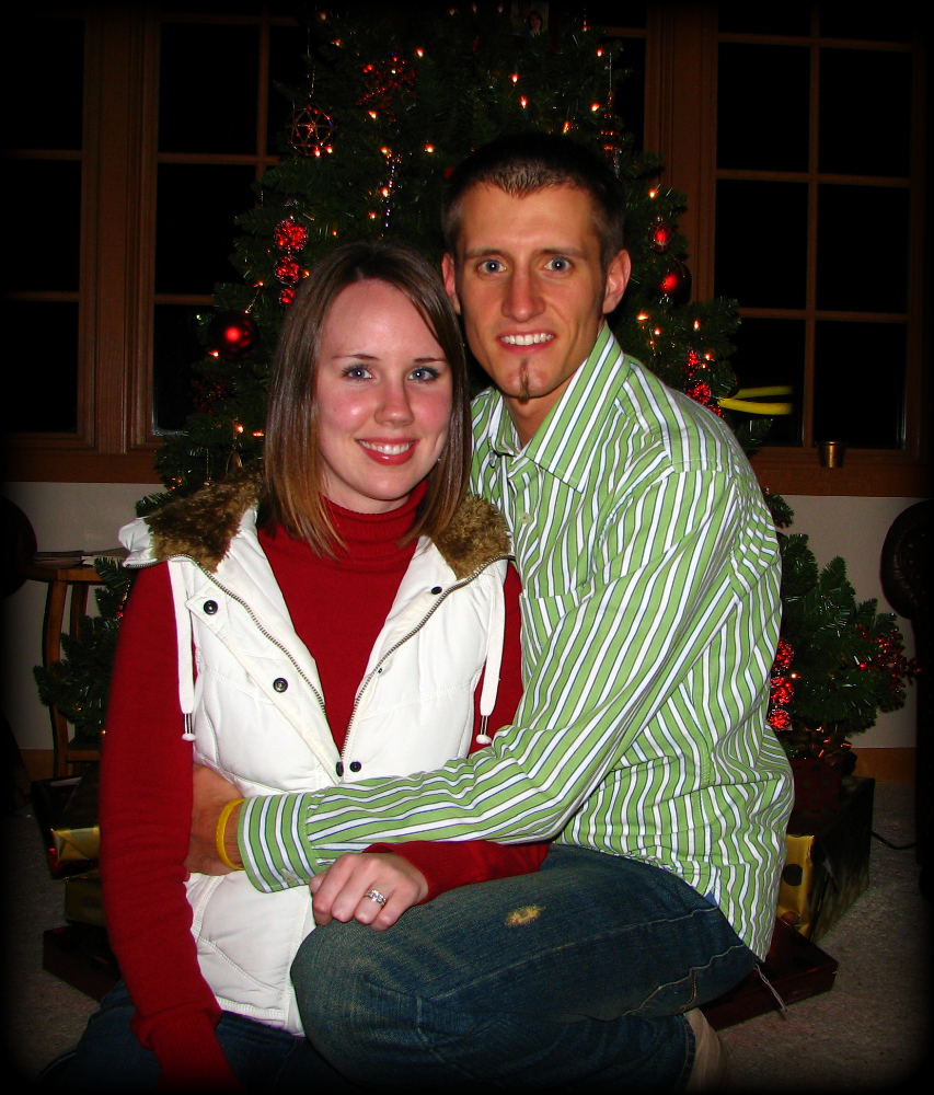
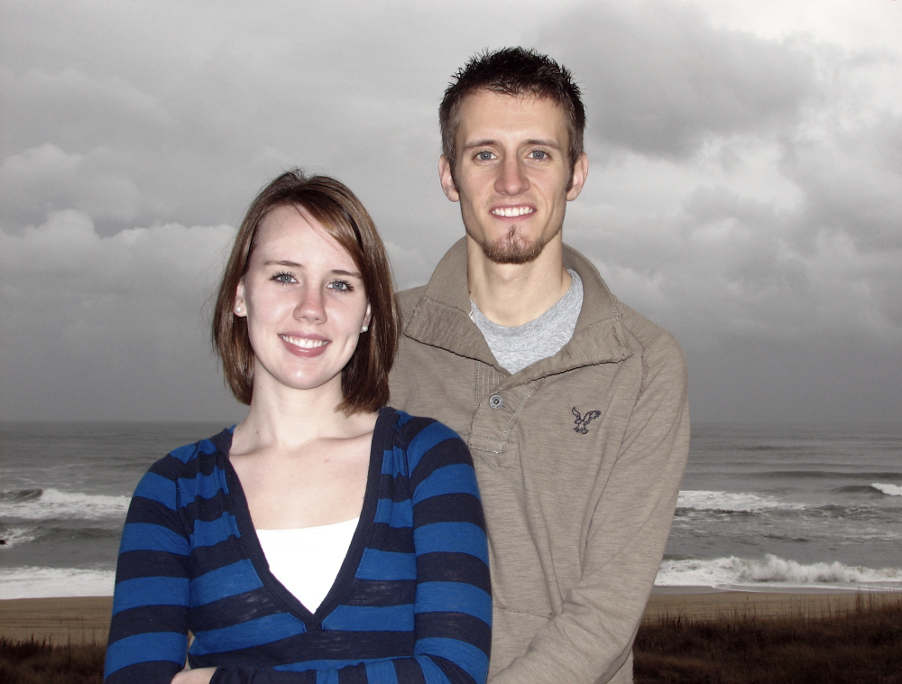
59 Church St. (c. 1735) - Thomas Rose's House

Plaque on the wall outside the house

Vine wall adjacent to the house

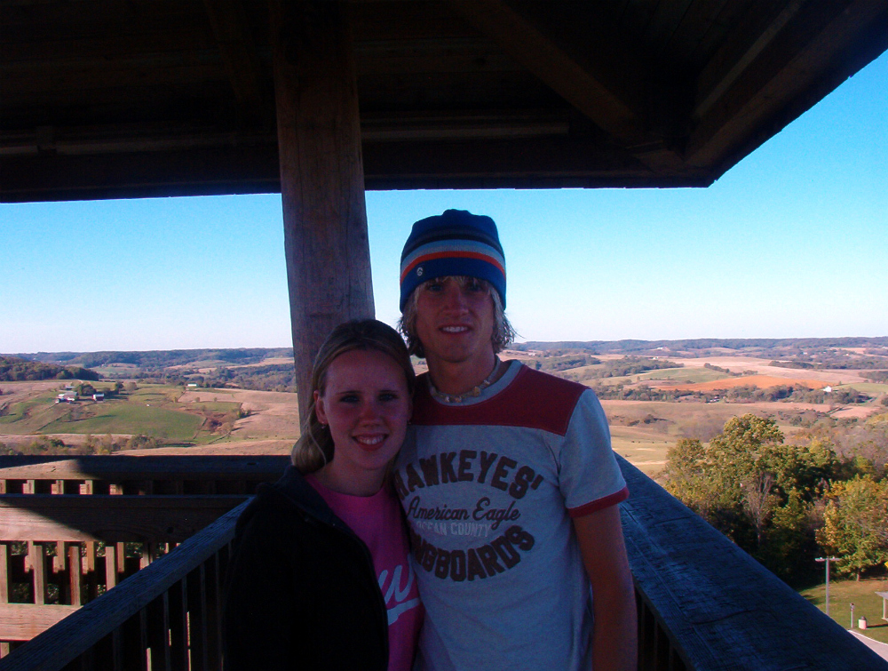
Which is where Stacie and I took our picture for our 2010 Christmas card
(December 4, 2010)

Plaque on the wall outside the house

Vine wall adjacent to the house

Which is where Stacie and I took our picture for our 2010 Christmas card
(December 4, 2010)

62 Church St.
 60 Church St. (c. 1765) - Verree-Duvall House


Plaque on the wall outside the house

Golf cart at 60 Church St., a preferred mode of transportation on the narrow and crowded streets of downtown.

58 Church St. (c. 1754) - James Verree House

Plaque on the wall outside the house

55 Church St. (c. 1818) - Benjamin Phillips Catherine Jefferies House

Plaque on the wall outside the house

Plaque on the wall outside the house

53 Church St. (c. 1760) - Joseph Ball House

Plaque on the wall outside the house

50 Church St.

47 Church St. (c. 1767) - Joseph Verree House

Plaque on the wall outside the house

45 Church St.

45 Church St. (facing Water St.)

41 Church St.

39 Church St. (c. 1743) - George Everleigh House

Plaque on the wall outside the house

37 Church St.

35 Church St. (c. 1770) - Young-Johnson House

Plaque on the wall outside the house

34 Church St.

38 Church St. (c. 1812) - Dr. Vincent Le Seigneur House

Plaque on the wall outside the house

42 Church St. (c. 1905) - Brailford & Susan Jenkins House

Plaque on the wall outside the house
Given that I took 5 hours to take pictures this day, and that I could only park in the 2-hour parking spots, I had to walk back to move my car twice. The last time, I saw the Carinval Fantasy leaving Charleston Harbor for the Bahamas.

Passengers on deck for their departure

Bon voyage

The Carnival Fantasy, fronted by HHL Valparaiso

The cruise ship was 4 miles away from me here. Fort Sumter is in the foreground.

I didn't know we grew bananas in Chalreston

16 Water St.

13 Water St.

9 Water St.

5 Water St.

12 Water St.

8 Water St.

A bride and groom in a horse-drawn carriage along The Battery

6 Water St. (c. 1820s) - Francis Saltus House

Plaque on the wall outside the house
 6 and 2 Water St. (driveways)
1 Water St.
The 1886 Charleston earthquake caused this house and many others to shift on their foundations.
The 1886 Charleston earthquake caused this house and many others to shift on their foundations.

3 Water St.

2 Water St.

The Battery at sunset

Cornices of the Porcher-Simonds House

December sunset over The Battery

Dock Street Theatre (c. 1809)
Though this theatre is not part of the South Of Broad district, it is especially festive at Christmas and I couldn't pass up this night shot of the theatre.
Though this theatre is not part of the South Of Broad district, it is especially festive at Christmas and I couldn't pass up this night shot of the theatre.

That's a whole series of posts for another time...Charleston at night.
That's all for this post, this gallery, and this blog...for 2012. I will continue this gallery and hopefully blog more frequently in 2013. With a new camera, more ground to cover South Of Broad, and an undeniable infrequency of posts this past year, I have little excuse to prolong additional posts.
That's all for this post, this gallery, and this blog...for 2012. I will continue this gallery and hopefully blog more frequently in 2013. With a new camera, more ground to cover South Of Broad, and an undeniable infrequency of posts this past year, I have little excuse to prolong additional posts.
A new TIME, new and familiar SPACE(s)...happy new year!


0 comments:
Post a Comment