
WHEN: 2001 - present
WHERE: Take a look...
Oh, hi.
Welcome to my favorite post I've added to date. I should also note that it is my 100th post, but that's not why it's my favorite. I have had the idea for this post for months now, and on and off I have spent the past 6 weeks putting it together (with some outside help). I wanted to get it posted before I disappeared from the blogoshere over Christmas break, prolonging its completion even longer.
I got the idea from another blog, which I ran across a while back using the "Next Blog>>" feature at the top left of each blog. This particular blog ("Sarah Ortega Photography") had pictures of Sarah and her husband posted down the sidebar, with a heading stating where the picture was taken. I loved the idea, and seeing as how my blog is about time and space, I had to be a copy cat. Plus I added a couple new features of my own.
I do have to thank those who helped me with some of the "where" info: Emily & Keith Sandison, Steph Armstrong, Julie Kapanka, my sister, and my dad. They all happily helped out, none of them knowing or asking why I was inquiring about such an odd thing.
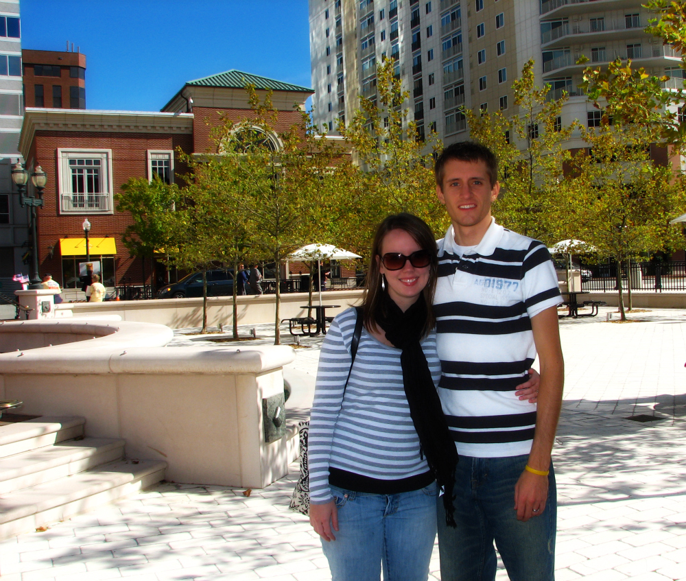
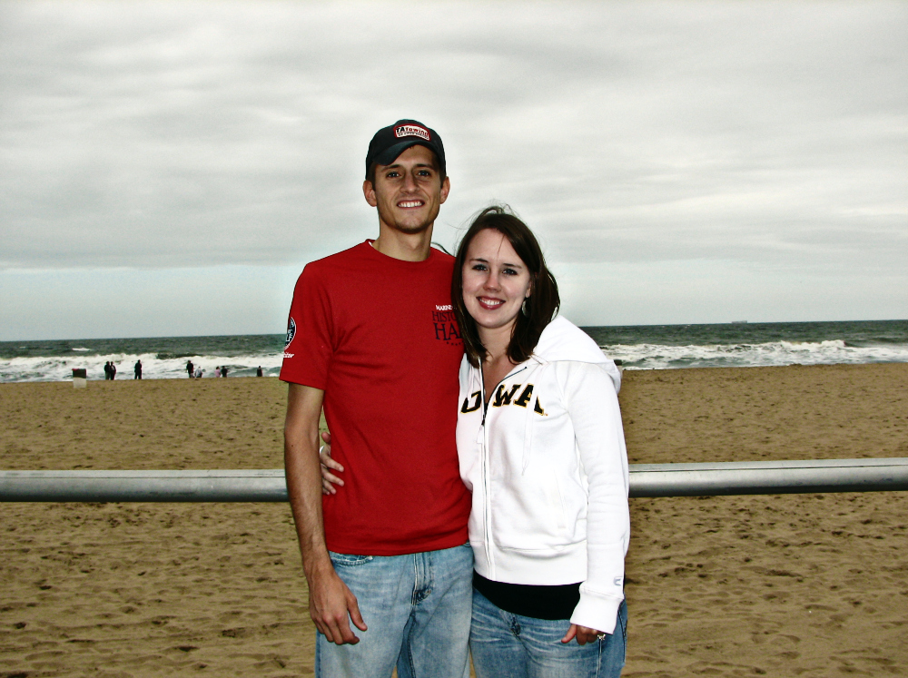
I scanned through all my pictures over the past 9 years and selected pictures of Stace and I in different places at different times. I researched and mapped each location and came up with the closest coordinates of where we were and provided map hyperlinks (MAP IT!) of the exact place where the picture was taken. The MAP IT! feature is found at the bottom of each picture's information and provides a direct link to a map of exactly where the picture was taken.
I spent a significant amount of time trying to determine the exact coordinates of where the picture was taken. For example, if the picture was taken at a football stadium, I didn't just provide the coordinates for the stadium. Rather, I attempted my best guess of the bleachers we were sitting on. Similarly, if the picture was taken on a beach, I tried to identify the exact coordinates at that beach, and not just the beach itself. I was as specific on the location as I could be for each picture. That's because I am a geographer (with OCD) and that's what geographers do. But if you have read my blog for any amount of time, you're not surprised by any of this. I also provided the actual/closest place name and address of each picture. This information made identifying the actual address and coordinates of some unknown places possible, and so again I thank those that helped me out with those picture's locations.
First, I present the maps. Of course I had to include maps because it's in my nature. I limited it to two maps so, 1) I wouldn't overload Blogger's servers with any more pictures from this post and 2) to prevent boring those not geographically inclined (most of those reading).


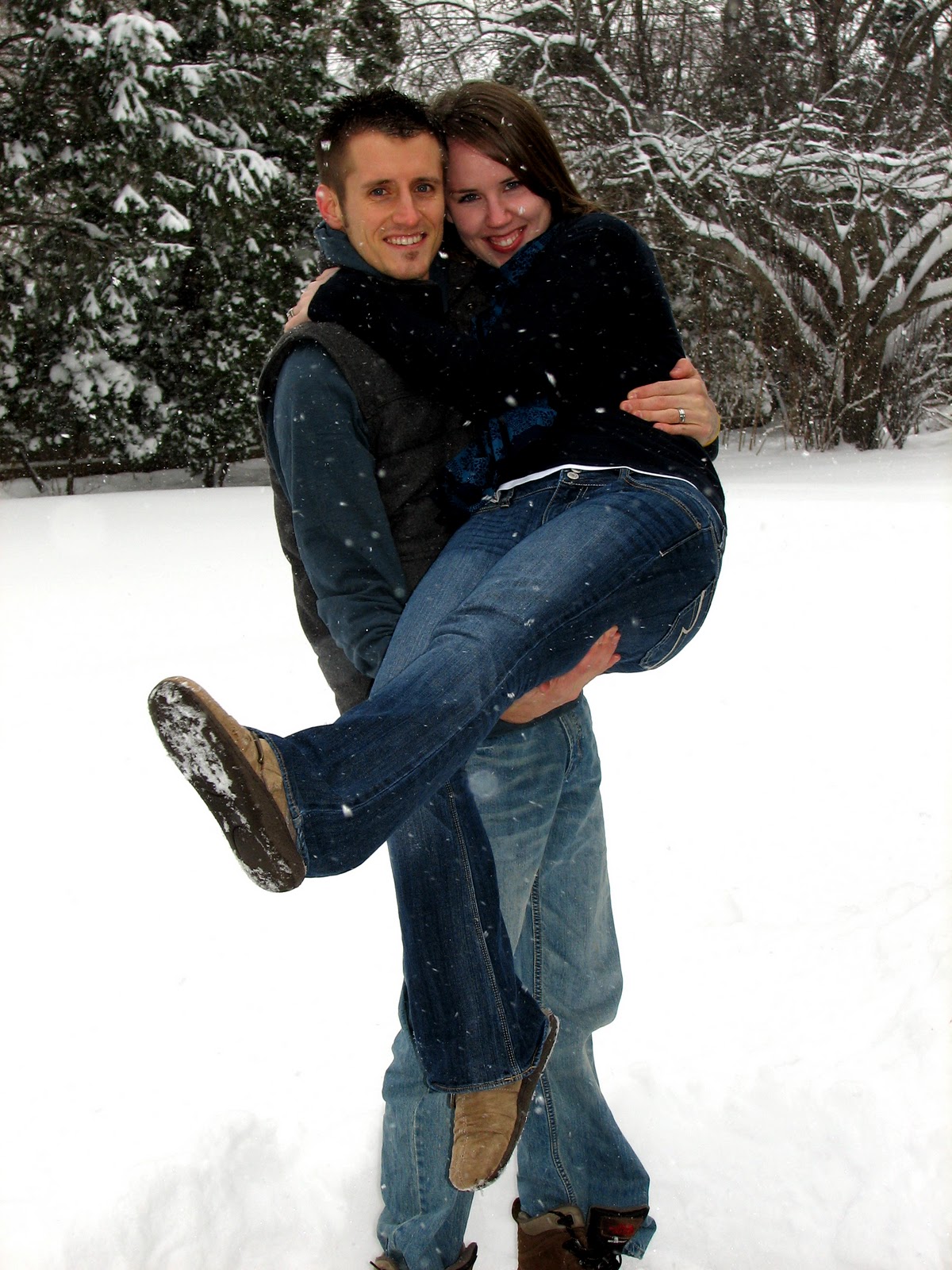
 WHEN: June 1, 2007


Cedar Falls, Iowa


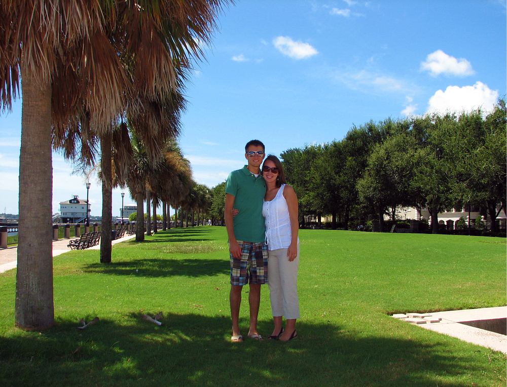
Atlanta, Georgia

WHERE: Take a look...
**LAST UPDATED**
November 24, 2013
Oh, hi.
Welcome to my favorite post I've added to date. I should also note that it is my 100th post, but that's not why it's my favorite. I have had the idea for this post for months now, and on and off I have spent the past 6 weeks putting it together (with some outside help). I wanted to get it posted before I disappeared from the blogoshere over Christmas break, prolonging its completion even longer.
I got the idea from another blog, which I ran across a while back using the "Next Blog>>" feature at the top left of each blog. This particular blog ("Sarah Ortega Photography") had pictures of Sarah and her husband posted down the sidebar, with a heading stating where the picture was taken. I loved the idea, and seeing as how my blog is about time and space, I had to be a copy cat. Plus I added a couple new features of my own.
I do have to thank those who helped me with some of the "where" info: Emily & Keith Sandison, Steph Armstrong, Julie Kapanka, my sister, and my dad. They all happily helped out, none of them knowing or asking why I was inquiring about such an odd thing.
I scanned through all my pictures over the past 9 years and selected pictures of Stace and I in different places at different times. I researched and mapped each location and came up with the closest coordinates of where we were and provided map hyperlinks (MAP IT!) of the exact place where the picture was taken. The MAP IT! feature is found at the bottom of each picture's information and provides a direct link to a map of exactly where the picture was taken.
I spent a significant amount of time trying to determine the exact coordinates of where the picture was taken. For example, if the picture was taken at a football stadium, I didn't just provide the coordinates for the stadium. Rather, I attempted my best guess of the bleachers we were sitting on. Similarly, if the picture was taken on a beach, I tried to identify the exact coordinates at that beach, and not just the beach itself. I was as specific on the location as I could be for each picture. That's because I am a geographer (with OCD) and that's what geographers do. But if you have read my blog for any amount of time, you're not surprised by any of this. I also provided the actual/closest place name and address of each picture. This information made identifying the actual address and coordinates of some unknown places possible, and so again I thank those that helped me out with those picture's locations.
First, I present the maps. Of course I had to include maps because it's in my nature. I limited it to two maps so, 1) I wouldn't overload Blogger's servers with any more pictures from this post and 2) to prevent boring those not geographically inclined (most of those reading).

Yellow dots represent where the pictures of Stace and I below were taken
(as of November 2010)
(as of November 2010)

The farthest north, south, east, and west the pictures of us below were taken
(as of November 2010)
(as of November 2010)
Now, go find where the Brasses are...
Waterloo, Iowa
(our first picture together)
(our first picture together)

WHEN: May 27, 2001
WHERE: Lost Island Water Park
ADDRESS: 2225 East Shaulis Rd.
CITY: Waterloo
STATE: Iowa
LATITUDE: 42° 26' 37.30"N
LONGITUDE: 92° 18' 44.03"W
Des Moines, Iowa

WHEN: April 26, 2002
WHERE: Drake Stadium
ADDRESS: 2719 Forest Ave.
CITY: Des Moines
STATE: Iowa
LATITUDE: 41° 36' 20.47"N
LONGITUDE: 93° 39' 16.43"W
Cedar Falls, Iowa

WHEN: September 24, 2002
WHERE: Sheriff Field (UNI Dome)
ADDRESS: 2401 Hudson Rd.
CITY: Cedar Falls
STATE: Iowa
LATITUDE: 42° 30' 56.00"N
LONGITUDE: 92° 28' 02.00"W
Iowa City, Iowa

WHEN: November 9, 2002
WHERE: Kinnick Stadium
ADDRESS: 886 Stadium Dr.
CITY: Iowa City
STATE: Iowa
LATITUDE: 41° 39' 29.58"N
LONGITUDE: 91° 33' 06.74"W
Naples, Florida

WHEN: July 31, 2003
WHERE: The Sandpiper (at Pelican Bay)
ADDRESS: 6251 Pelican Bay Blvd.
CITY: Naples
STATE: Florida
LATITUDE: 26° 14' 10.17"N
LONGITUDE: 81° 49' 11.15"W
Naples, Florida

WHEN: August 3, 2003
WHERE: La Playa Beach Resort
ADDRESS: 9891 Gulf Shore Dr.
CITY: Naples
STATE: Florida
LATITUDE: 26° 15' 38.65"N
LONGITUDE: 81° 49' 29.05"W
Grand Haven, Michigan

WHEN: January 2, 2004
WHERE: Grand Haven South Pier
ADDRESS: S. Harbor Dr.
CITY: Grand Haven
STATE: Michigan
LATITUDE: 43° 03' 26.33"N
LONGITUDE: 86° 15' 11.44"W
Wrightsville Beach, North Carolina

WHEN: March 2004
WHERE: Wrightsville Beach
ADDRESS: N. Ridge Ln.
CITY: Wrightsville Beach
STATE: North Carolina
LATITUDE: 34° 13' 33.65"N
LONGITUDE: 77° 46' 51.30"W
Mears, Michigan

WHEN: July 31, 2004
WHERE: Silver Lake State Park
ADDRESS: N. Lighthouse Dr.
CITY: Golden Township
STATE: Michigan
LATITUDE: 43° 40' 15.17"N
LONGITUDE: 86° 31' 58.89"W
Muskegon, Michigan

WHEN: August 1, 2004
WHERE: Getty 4 Drive-In Theatre
ADDRESS: 920 E. Summit Ave
CITY: Muskegon
STATE: Michigan
LATITUDE: 43° 11' 48.55"N
LONGITUDE: 86° 13' 17.89"W
Chicago, Illinois

WHEN: August 5, 2004
WHERE: The Sears Tower (now Willis Tower)
ADDRESS: 233 S. Wacker Dr.
CITY: Chicago
STATE: Illinois
LATITUDE: 41° 52' 44.25"N
LONGITUDE: 87° 38' 07.95"W
Dubuque, Iowa

WHEN: October 3, 2004
WHERE: Eagle Point Park
ADDRESS: Memorial Ln.
CITY: Dubuque
STATE: Iowa
LATITUDE: 42° 32' 22.45"N
LONGITUDE: 90° 38' 52.37"W
Elizabeth, Illinois

WHEN: October 3, 2004
ADDRESS: US Hwy. 20
CITY: Elizabeth
STATE: Illinois
LATITUDE: 42° 19' 59.35"N
LONGITUDE: 90° 16' 20.35"W
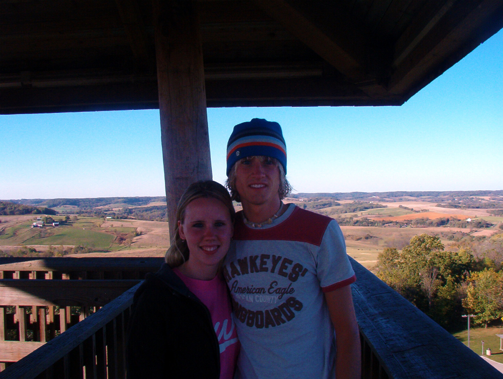
Owatonna, Minnesota

WHEN: December 29, 2004
WHERE: Cabela's
ADDRESS: 3900 Cabela Dr.
CITY: Owatonna
STATE: Minnesota
LATITUDE: 44° 08' 04.45"N
LONGITUDE: 93° 15' 02.54"W
Duluth, Minnesota

WHEN: July 2, 2005
WHERE: Duluth Downtown Lakewalk (Canal Park)
ADDRESS: Canal Park Blvd.
CITY: Duluth
STATE: Minnesota
LATITUDE: 46° 46' 52.95"N
LONGITUDE: 92° 05' 30.62"W
Two Harbors, Minnesota

WHEN: July 2, 2005
WHERE: Goosebury Falls State Park
ADDRESS: MN Hwy. 61
CITY: Two Harbors
STATE: Minnesota
LATITUDE: 47° 08' 33.95"N
LONGITUDE: 91° 28' 04.70"W
Phoenix, Arizona

WHEN: August 6, 2005
ADDRESS: 3400 E. Sky Harbor Blvd.
CITY: Phoenix
STATE: Arizona
LATITUDE: 33° 26' 06.21"N
LONGITUDE: 112° 00' 31.87"W
Gilbert, Arizona

WHEN: August 8, 2005
WHERE: {residence}
ADDRESS: 1125 E. Southshore Dr.
CITY: Gilbert
STATE: Arizona
LATITUDE: 33° 21' 08.96"N
LONGITUDE: 111° 45' 55.36"W
Pine, Arizona

WHEN: August 9, 2005
ADDRESS: Nf-583A
CITY: Pine
STATE: Arizona
LATITUDE: 34° 19' 13.43"N
LONGITUDE: 111° 27' 23.01"W
Scottsdale, Arizona

WHEN: August 10, 2005
WHERE: Southwestern Reflections
ADDRESS: 7221 E 1st Ave
CITY: Scottsdale
STATE: Arizona
LATITUDE: 33° 29' 37.67"N
LONGITUDE: 111° 55' 31.40"W
Guttenberg, Iowa

WHEN: August 20, 2005
WHERE: Mississippi River (near Guttenberg Marina)
ADDRESS: River View Dr.
CITY: Guttenberg
STATE: Iowa
LATITUDE: 42° 49' 10.97"N
LONGITUDE: 91° 05' 55.24"W
Galena, Illinois

WHEN: October 16, 2005
WHERE: Dowling House
ADDRESS: 220 Diagonal Street
CITY: Galena
STATE: Illinois
LATITUDE: 42° 25' 01.73"N
LONGITUDE: 90° 25' 36.62"W
Guttenberg, Iowa

WHEN: October 31, 2005
WHERE: Mississippi River (near Guttenberg Marina)
ADDRESS: River View Dr.
CITY: Guttenberg
STATE: Iowa
LATITUDE: 42° 49' 11.15"N
LONGITUDE: 91° 05' 56.21"W
Norton Shores, Michigan

WHEN: January 1, 2006
WHERE: Lake Harbor Park
ADDRESS: Lake Harbor Rd.
CITY: Norton Shores
STATE: Michigan
LATITUDE: 43° 10' 05.85"N
LONGITUDE: 86° 17' 57.65"W
Cedar Falls, Iowa

WHEN: June 29, 2006
WHERE: Cedar River (near Black Hawk Park)
ADDRESS: W. Cedar Wapsi Rd.
CITY: Cedar Falls
STATE: Iowa
LATITUDE: 42° 36' 47.86"N
LONGITUDE: 92° 29' 46.19"W
Elizabeth, Illinois

WHEN: August 13, 2006
ADDRESS: US Hwy. 20
CITY: Elizabeth
STATE: Illinois
LATITUDE: 42° 20' 00.30"N
LONGITUDE: 90° 16' 23.35"W
Grand Haven, Michigan

WHEN: August 14, 2006
WHERE: Grand Haven State Park
ADDRESS: S. Harbor Dr.
CITY: Grand Haven
STATE: Michigan
LATITUDE: 43° 03' 11.41"N
LONGITUDE: 86° 14' 47.47"W
Ludington, Michigan

WHEN: August 16, 2006
WHERE: Ludington State Park (Canoe Trail)
ADDRESS: Co. Rd. 116
CITY: Ludington
STATE: Michigan
LATITUDE: 44° 01' 30.55"N
LONGITUDE: 86° 28' 23.65"W
Bloomington, Minnesota

WHEN: September 4, 2006
WHERE: Hiawatha Lightrail (at Mall of America)
ADDRESS: Killebrew Dr.
CITY: Bloomington
STATE: Minnesota
LATITUDE: 44° 51' 10.05"N
LONGITUDE: 93° 14' 19.90"W
Elizabeth, Illinois

WHEN: October 15, 2006
ADDRESS: US Hwy. 20
CITY: Elizabeth
STATE: Illinois
LATITUDE: 42° 19' 58.72"N
LONGITUDE: 90° 16' 22.82"W
Shakopee, Minnesota

WHEN: November 23, 2006
WHERE: Memorial Park
ADDRESS: 1801 MN Hwy. 101
CITY: Shakopee
STATE: Minnesota
LATITUDE: 44° 48' 10.45"N
LONGITUDE: 93° 30' 08.12"W
Cedar Falls, Iowa

WHERE: Park Place Events Centre
ADDRESS: 1521 Technology Pkwy.
CITY: Cedar Falls
STATE: Iowa
LATITUDE: 42° 28' 30.15"N
LONGITUDE: 92° 27' 50.09"W
Fort Myers, Florida

WHEN: June 9, 2007
WHERE: Adventures in Paradise (Sunset Dolphin Cruise)
ADDRESS: 14341 Port Comfort Rd.
CITY: Fort Myers
STATE: Florida
LATITUDE: 26° 29' 25.18"N
LONGITUDE: 82° 00' 55.00"W
Sanibel, Florida

WHEN: June 10, 2007
WHERE: Sanibel Arms West
ADDRESS: E. Gulf Dr.
CITY: Sanibel
STATE: Florida
LATITUDE: 26° 26' 26.00"N
LONGITUDE: 82° 01' 59.60"W
Grand Haven, Michigan

WHEN: June 29, 2007
WHERE: Lakeshore Bed & Breakfast
ADDRESS: 11001 Lakeshore Dr.
CITY: Grand Haven
STATE: Michigan
LATITUDE: 42° 58' 06.52"N
LONGITUDE: 86° 13' 19.35"W
Grand Haven, Michigan

WHEN: June 30, 2007
WHERE: Lakeshore Baptist Church
ADDRESS: 13664 Lakeshore Dr.
CITY: Grand Haven
STATE: Michigan
LATITUDE: 43° 01' 01.95"N
LONGITUDE: 86° 13' 03.95"W
Crooked Oak, North Carolina

WHEN: July 16, 2007
ADDRESS: I-77/74
CITY: Crooked Oak
STATE: North Carolina
LATITUDE: 36° 33' 34.65"N
LONGITUDE: 80° 44' 48.27"W
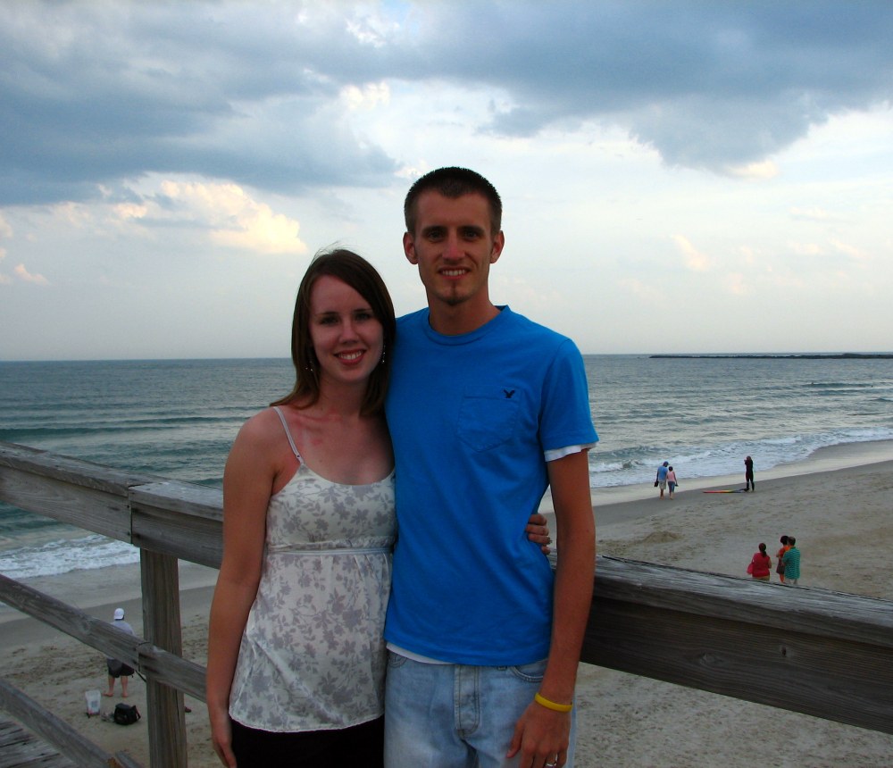
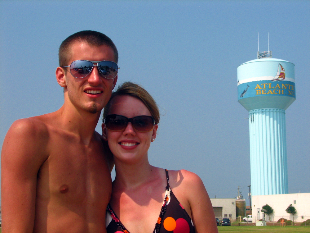
Atlantic Beach, North Carolina

WHEN: August 8, 2007
WHERE: Atlantic Beach
ADDRESS: Atlantic Blvd.
CITY: Atlantic Beach
STATE: North Carolina
LATITUDE: 34° 41' 54.59"N
LONGITUDE: 76° 44' 20.64"W
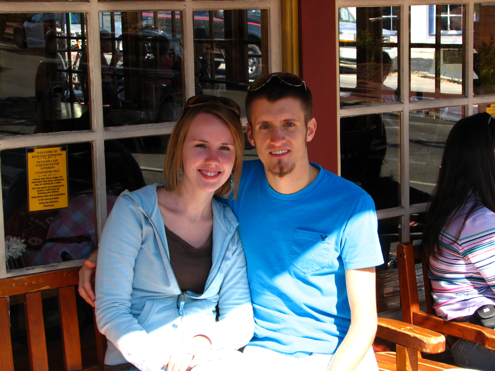
Fredericksburg, Virginia

WHEN: October 13, 2007
WHERE: Hyperion Espresso
ADDRESS: 301 William St.
CITY: Fredericksburg
STATE: Virginia
LATITUDE: 38° 18' 11.91"N
LONGITUDE: 77° 27' 39.10"W
Wake Forest, North Carolina

WHEN: November 22, 2007
WHERE: {residence}
ADDRESS: 7201 Mira Mar Place
CITY: Wake Forest
STATE: North Carolina
LATITUDE: 35° 58' 53.17"N
LONGITUDE: 78° 37' 27.60"W
Kill Devil Hills, North Carolina

WHEN: December 16, 2007
WHERE: Ramada Inn
ADDRESS: 1701 S Virginia Dare Trail
CITY: Kill Devil Hills
STATE: North Carolina
LATITUDE: 35° 59' 59.24"N
LONGITUDE: 75° 38' 51.75"W
Cape Hatteras National Seashore, North Carolina

WHEN: December 16, 2007
ADDRESS: NC Hwy. 12
CITY: -
STATE: North Carolina
LATITUDE: 35° 46' 10.03"N
LONGITUDE: 75° 31' 25.03"W
Waterloo, Iowa

WHEN: December 25, 2007
WHERE: {residence}
ADDRESS: 155 Hillcrest Rd.
CITY: Waterloo
STATE: Iowa
LATITUDE: 42° 28' 11.21"N
LONGITUDE: 92° 21' 40.30"W
Washington DC

WHEN: March 8, 2008
WHERE: The National Mall
ADDRESS: Jefferson Dr. SW
CITY: -
STATE: Washington DC
LATITUDE: 38° 53' 22.18"N
LONGITUDE: 77° 01' 33.34"W
Wrightsville Beach, North Carolina

WHEN: May 10, 2008
WHERE: Oceanic Restaurant (LIVE, panning webcam)
ADDRESS: 703 S. Lumina Blvd.
CITY: Wrightsville Beach
STATE: North Carolina
LATITUDE: 34° 11' 35.91"N
LONGITUDE: 77° 48' 16.35"W
Cedar Falls, Iowa

WHEN: June 2, 2008
WHERE: Ferrari's Ristorante
ADDRESS: 1521 Technology Pkwy.
CITY: Cedar Falls
STATE: Iowa
LATITUDE: 42° 28' 28.45"N
LONGITUDE: 92° 27' 49.95"W
MAP IT!
MAP IT!
Cedar Falls, Iowa

WHEN: June 6, 2008
WHERE: Park Place Events Centre
ADDRESS: 1521 Technology Pkwy.
CITY: Cedar Falls
STATE: Iowa
LATITUDE: 42° 28' 29.09"N
LONGITUDE: 92° 27' 50.55"W
Washington, North Carolina

WHEN: July 4, 2008
WHERE: July 4th fireworks show
ADDRESS: E. Water St.
CITY: Washington
STATE: North Carolina
LATITUDE: 35° 32' 23.74"N
LONGITUDE: 77° 03' 16.84"W
Virginia Beach, Virginia

WHEN: July 23, 2008
WHERE: Westin Inn Virginia Beach
ADDRESS: 4535 Commerce St.
CITY: Virginia Beach
STATE: Virginia
LATITUDE: 36° 50' 29.61"N
LONGITUDE: 76° 08' 08.34"W
Duck, North Carolina

WHEN: July 24, 2008
WHERE: Sunset Grille & Raw Bar
ADDRESS: 1245 Duck Rd.
CITY: Duck
STATE: North Carolina
LATITUDE: 36° 10' 30.13"N
LONGITUDE: 75° 45' 24.01"W
Buxton, North Carolina

WHEN: July 24, 2008
WHERE: Cape Hatteras Lighthouse
ADDRESS: Lighthouse Rd.
CITY: Buxton
STATE: North Carolina
LATITUDE: 35° 15' 03.55"N
LONGITUDE: 75° 31' 46.30"W
Ocracoke, North Carolina

WHEN: July 24, 2008
WHERE: Ocracoke Beach
ADDRESS: Irvin Garrish Hwy.
CITY: Ocracoke
STATE: North Carolina
LATITUDE: 35° 06' 24.87"N
LONGITUDE: 75° 57' 06.58"W
Fredericksburg, Virginia

WHEN: August 30, 2008
WHERE: The Gauntlet Golf Club
ADDRESS: 18 Fairway Dr.
CITY: Fredericksburg
STATE: Virginia
LATITUDE: 38° 26' 01.86"N
LONGITUDE: 77° 34' 25.79"W
Wrightsville Beach, North Carolina

WHEN: September 1, 2008
WHERE: Wrightsville Beach
ADDRESS: E. Oxford St.
CITY: Wrightsville Beach
STATE: North Carolina
LATITUDE: 34° 12' 44.36"N
LONGITUDE: 77° 47' 21.47"W
Greenville, North Carolina

WHEN: September 3, 2008
WHERE: {residence}
ADDRESS: 1653 Wimbledon Dr.
CITY: Greenville
STATE: North Carolina
LATITUDE: 35° 34' 04.07"N
LONGITUDE: 77° 21' 55.40"W
Washington DC

WHEN: October 11, 2008
WHERE: The U.S. White House
ADDRESS: 1600 Pennsylvania Ave.
CITY: -
STATE: Washington DC
LATITUDE: 38° 53' 54.77"N
LONGITUDE: 77° 02' 11.60"W
Washington DC

WHEN: October 11, 2008
WHERE: The Lincoln Memorial
ADDRESS: Lincoln Memorial Circle
CITY: -
STATE: Washington DC
LATITUDE: 38° 53' 21.33"N
LONGITUDE: 77° 03' 00.31"W
Greenville, North Carolina

WHEN: November 8, 2008
WHERE: Dowdy-Ficklen Stadium (East Carolina University)
ADDRESS: 100 Ficklen St.
CITY: Greenville
STATE: North Carolina
LATITUDE: 35° 35' 47.60"N
LONGITUDE: 77° 21' 51.88"W
Cape Hatteras National Seashore

WHEN: November 28, 2008
ADDRESS: NC Hwy. 12
CITY: -
STATE: North Carolina
LATITUDE: 35° 46' 15.20"N
LONGITUDE: 75° 31' 23.10"W
Kitty Hawk, North Carolina

WHEN: December 13, 2008
WHERE: Hilton Garden Inn
ADDRESS: 5353 North Virginia Dare Trail
CITY: Kitty Hawk
STATE: North Carolina
LATITUDE: 36° 06' 01.25"N
LONGITUDE: 75° 42' 42.00"W
Waterloo, Iowa

WHEN: December 24, 2008
WHERE: {residence}
ADDRESS: 155 Hillcrest Rd.
CITY: Waterloo
STATE: Iowa
LATITUDE: 42° 28' 11.21"N
LONGITUDE: 92° 21' 40.29"W
Cedar Falls, Iowa

WHEN: December 25, 2008
WHERE: {residence}
ADDRESS: 915 W 9th
CITY: Cedar Falls
STATE: Iowa
LATITUDE: 42° 31' 50.00"N
LONGITUDE: 92° 27' 23.63"W
Wilmington, North Carolina

WHEN: March 22, 2009
WHERE: Peacemaker (ship)
ADDRESS: N. Water St.
CITY: Wilimington
STATE: North Carolina
LATITUDE: 34° 14' 08.36"N
LONGITUDE: 77° 57' 00.47"W
Wrightsville Beach, North Carolina

WHEN: March 22, 2009
WHERE: Wrightsville Beach
ADDRESS: 2700 N. Lumina Ave.
CITY: Wrightsville Beach
STATE: North Carolina
LATITUDE: 34° 14' 05.75"N
LONGITUDE: 77° 46' 27.55"W
Charleston, South Carolina

WHEN: April 5, 2009
WHERE: Waterfront Park
ADDRESS: 1 Vendue Range
CITY: Charleston
STATE: South Carolina
LATITUDE: 32° 46' 37.80"N
LONGITUDE: 79° 55' 31.37"W
Mount Pleasant, South Carolina

WHEN: April 6, 2009
WHERE: Boone Hall Plantation
ADDRESS: 1235 Long Point Rd.
CITY: Mount PLeasant
STATE: South Carolina
LATITUDE: 32° 51' 26.08"N
LONGITUDE: 79° 49' 23.89"W
Minneapolis, Minnesota

WHEN: April 11, 2009
WHERE: Peavey Plaza
ADDRESS: Nicollet Ave.
CITY: Minneapolis
STATE: Minnesota
LATITUDE: 44° 58' 19.56"N
LONGITUDE: 93° 16' 32.28"W
Fredericksburg, Virginia

WHEN: May 17, 2009
ADDRESS: 2371 Carl D Silver Pkwy.
CITY: Fredericksburg
STATE: Virginia
LATITUDE: 38° 18' 56.51"N
LONGITUDE: 77° 30' 28.48"W
Wrightsville Beach, North Carolina

WHEN: May 24, 2009
WHERE: Wrightsville Beach
ADDRESS: Jack Parker Blvd.
CITY: Wrightsville Beach
STATE: North Carolina
LATITUDE: 34° 11' 12.84"N
LONGITUDE: 77° 48' 32.70"W
Greenville, North Carolina

WHEN: June 1, 2009
WHERE: Finelli's Café
ADDRESS: 511 Red Banks Rd.
CITY: Greenville
STATE: North Carolina
LATITUDE: 35° 34' 54.70"N
LONGITUDE: 77° 22' 15.28"W
Virginia Beach, Virginia

WHEN: September 26, 2009
WHERE: Virginia Beach Boardwalk
ADDRESS: 30th St.
CITY: Virginia Beach
STATE: Virginia
LATITUDE: 36° 51' 31.27"N
LONGITUDE: 75° 58' 37.44"W
Virginia Beach, Virginia

WHEN: October 22, 2009
WHERE: Virginia Beach Town Center
ADDRESS: Central Park Ave.
CITY: Virginia Beach
STATE: Virginia
LATITUDE: 36° 50' 32.95"N
LONGITUDE: 76° 08' 03.34"W
Fredericksburg, Virginia

WHEN: October 25, 2009
ADDRESS: Sunken Rd.
CITY: Fredericksburg
STATE: Virginia
LATITUDE: 38° 17' 38.05"N
LONGITUDE: 77° 28' 07.47"W
Waterloo, Iowa

WHEN: December 24, 2009
WHERE: {residence}
ADDRESS: 155 Hillcrest Rd.
CITY: Waterloo
STATE: Iowa
LATITUDE: 42° 28' 11.18"N
LONGITUDE: 92° 21' 40.29"W
Waterloo, Iowa
WHEN: April 4, 2010
WHERE: {residence}
ADDRESS: 155 Hillcrest Rd.
CITY: Waterloo
STATE: Iowa
LATITUDE: 42° 28' 11.25"N
LONGITUDE: 92° 21' 40.40"W
Norfolk, Virginia

WHEN: June 12, 2010
WHERE: The Pier at Brooke Avenue
ADDRESS: Brooke Ave.
CITY: Norfolk
STATE: Virginia
LATITUDE: 36° 50' 59.78"N
LONGITUDE: 76° 17' 44.88"W
Virginia Beach, Virginia

WHEN: July 28, 2010
ADDRESS: 3311 Shore Dr.
CITY: Virginia Beach
STATE: Virginia
LATITUDE: 36° 54' 21.81"N
LONGITUDE: 76° 05' 11.95"W
Williamsburg, Virginia

WHEN: July 29, 2010
WHERE: Merchants Square
ADDRESS: W. Duke of Gloucester St.
CITY: Williamsburg
STATE: Virginia
LATITUDE: 37° 16' 14.97"N
LONGITUDE: 76° 42' 21.81"W
Norfolk, Virginia

WHEN: July 31, 2010
WHERE: USS Wisconsin (BB-64)
ADDRESS: One Waterside Drive
CITY: Norfolk
STATE: Virginia
LATITUDE: 36° 50' 55.69"N
LONGITUDE: 76° 17' 46.96"W
Charleston, South Carolina

WHEN: August 10, 2010
WHERE: Waterfront Park
ADDRESS: 1 Vendue Range
CITY: Charleston
STATE: South Carolina
LATITUDE: 32° 46' 40.40"N
LONGITUDE: 79° 55' 30.22"W
Summerville, South Carolina

WHEN: November 20, 2010
WHERE: Azalea Park
ADDRESS: S. Main St.
CITY: Summerville
STATE: South Carolina
LATITUDE: 33° 00' 54.70"N
LONGITUDE: 80° 10' 50.90"W
Waterloo, Iowa

WHEN: December 24, 2010
WHERE: {residence}
ADDRESS: 155 Hillcrest Rd.
CITY: Waterloo
STATE: Iowa
LATITUDE: 42° 28' 11.11"N
LONGITUDE: 92° 21' 39.70"W
North Charleston, South Carolina

WHEN: April 24, 2011
WHERE: {residence}
ADDRESS: 5150 Trump St.
CITY: North Charleston
STATE: South Carolina
LATITUDE: 32° 55' 55.35"N
LONGITUDE: 80° 07' 41.60"W
Stockholm, Wisconsin

WHEN: June 8, 2011
WHERE: Grace Church Retreat Center
ADDRESS: Foster Rd.
CITY: Stockholm
STATE: Wisconsin
LATITUDE: 44° 30' 15.00"N
LONGITUDE: 92° 12' 52.85"W
Pisgah National Forest, North Carolina

WHEN: September 3, 2011
WHERE: Pisgah National Forest
ADDRESS: Blue Ridge Parkway (Hominy Valley Lookout)
CITY: -
STATE: North Carolina
LATITUDE: 35° 26' 51.50"N
LONGITUDE: 82° 43' 02.05"W
Great Smoky Mountains National Park, Tennessee


WHEN: September 4, 2011
ADDRESS: Little River Rd.(?)
CITY: -
STATE: Tennessee
LATITUDE: ?
LONGITUDE: ?
Gatlinburg, Tennessee

WHEN: September 6, 2011
WHERE: White Oak Lodge & Resort
ADDRESS: 157 Acadia Circle
CITY: Gatlinburg
STATE: Tennessee
LATITUDE: 35° 45' 24.85"N
LONGITUDE: 83° 21' 21.40"W
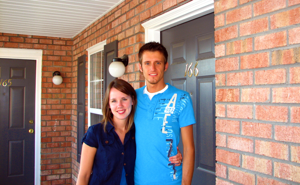
North Charleston, South Carolina

WHEN: September 8, 2011
WHERE: {residence}
ADDRESS: 5150 Trump St.
CITY: North Charleston
STATE: South Carolina
LATITUDE: 32° 55' 54.80"N
LONGITUDE: 80° 07' 41.15"W
Atlanta, Georgia

WHEN: October 9, 2011
WHERE: Georgia Dome
ADDRESS: 1 Georgia Dome Dr.
CITY: Atlanta
STATE: Georgia
LATITUDE: 33° 45' 24.75"N
LONGITUDE: 84° 24' 05.00"W
MAP IT!
Waterloo, Iowa
 WHEN: December 25, 2011
Myrtle Beach, South Carolina
 WHEN: May 12, 2012
Stockholm, Wisconsin

WHEN: June 7, 2012
Savannah, Georgia
 WHEN: July 23, 2012
Tybee Island, Georgia
 WHEN: July 23, 2012
Scottsdale, Arizona
 WHEN: September 2, 2012
WHERE: Kierland Commons (Plaza)
ADDRESS: E. Greenway Pkwy.
CITY: Scottsdale
STATE: Arizona
LATITUDE: 33° 37' 26.08"N
LONGITUDE: 111° 55' 42.88"W
MAP IT!
 WHEN: September 4, 2012
WHERE: Fountain Park
ADDRESS: N. Panorama Dr.
CITY: Fountain Hills
STATE: Arizona
LATITUDE: 33° 36' 07.30"N
LONGITUDE: 111° 42' 35.26"W
MAP IT!
Folly Beach, South Carolina
 WHEN: November 23, 2012
Waterloo, Iowa
 WHEN: December 24, 2012
Minneapolis, Minnesota
 WHEN: January 1, 2013
Fredericksburg, Virginia
 WHEN: April 1, 2013
Johns Island, South Carolina
 WHEN: April 21, 2013
Hunting Island State Park, South Carolina

WHEN: June 1, 2013
Asheville, North Carolina

WHEN: October 13, 2013
MAP IT!
Stay tuned to see where the Brasses go next!
MAP IT!
Waterloo, Iowa

WHERE: {residence}
ADDRESS: 155 Hillcrest Rd.
CITY: Waterloo
STATE: Iowa
LATITUDE: 42° 28' 11.18"N
LONGITUDE: 92° 21' 40.29"W
Myrtle Beach, South Carolina

WHERE: Damon's Grill
ADDRESS: 2985 South Ocean Blvd.
ADDRESS: 2985 South Ocean Blvd.
CITY: Myrtle Beach
STATE: South Carolina
LATITUDE: 33° 39' 33.70"N
LONGITUDE: 78° 54' 57.35"W
MAP IT!Stockholm, Wisconsin

WHEN: June 7, 2012
LATITUDE: 44° 30' 14.64"N
LONGITUDE: 92° 12' 52.15"W
MAP IT!Savannah, Georgia

LATITUDE: 32° 04' 50.54"N
LONGITUDE: 81° 05' 15.82''W
MAP IT!Tybee Island, Georgia

WHERE:
ADDRESS: 9th St.
ADDRESS: 9th St.
CITY: Tybee Island
STATE: Georgia
LATITUDE: 32° 00' 04.70"N
LONGITUDE: 80° 50' 30.20"W
MAP IT!Scottsdale, Arizona

WHERE: Kierland Commons (Plaza)
ADDRESS: E. Greenway Pkwy.
CITY: Scottsdale
STATE: Arizona
LATITUDE: 33° 37' 26.08"N
LONGITUDE: 111° 55' 42.88"W
MAP IT!
Fountain Hills, Arizona

WHERE: Fountain Park
ADDRESS: N. Panorama Dr.
CITY: Fountain Hills
STATE: Arizona
LATITUDE: 33° 36' 07.30"N
LONGITUDE: 111° 42' 35.26"W
MAP IT!
Folly Beach, South Carolina

LATITUDE: 32° 39' 14.70"N
LONGITUDE: 79° 56' 21.80"W
MAP IT!Waterloo, Iowa

WHERE: {residence}
ADDRESS: 155 Hillcrest Rd.
CITY: Waterloo
STATE: Iowa
LATITUDE: 42° 28' 11.18"N
LONGITUDE: 92° 21' 40.29"W
Minneapolis, Minnesota

WHERE: Minneapolis International Airport (Humphrey Terminal)
ADDRESS: 7159 Humphrey Dr.
CITY: Minneapolis
STATE: Minnesota
LATITUDE: 44° 52' 26.15" N
LONGITUDE: 93° 13' 39.50" W
Fredericksburg, Virginia

WHERE: Richard Johnston Inn
ADDRESS: 711 Caroline St.
ADDRESS: 711 Caroline St.
CITY: Fredericksburg
STATE: Virginia
LATITUDE: 38° 18' 04.55" N
LONGITUDE: 77° 27' 28.69" W
Johns Island, South Carolina

WHERE: Angel Oak
ADDRESS: 3688 Angel Oak Rd.
ADDRESS: 3688 Angel Oak Rd.
CITY: Johns Island
STATE: South Carolina
LATITUDE: 32° 43' 01.01" N
LONGITUDE: 80° 04' 49.42" W
Hunting Island State Park, South Carolina

WHEN: June 1, 2013
WHERE: Hunting Island State Park
ADDRESS: N. Beach Rd.
ADDRESS: N. Beach Rd.
CITY: St. Helena Island
STATE: South Carolina
LATITUDE: 32° 22' 21.80"N
LONGITUDE: 80° 26' 15.00"W
MAP IT!
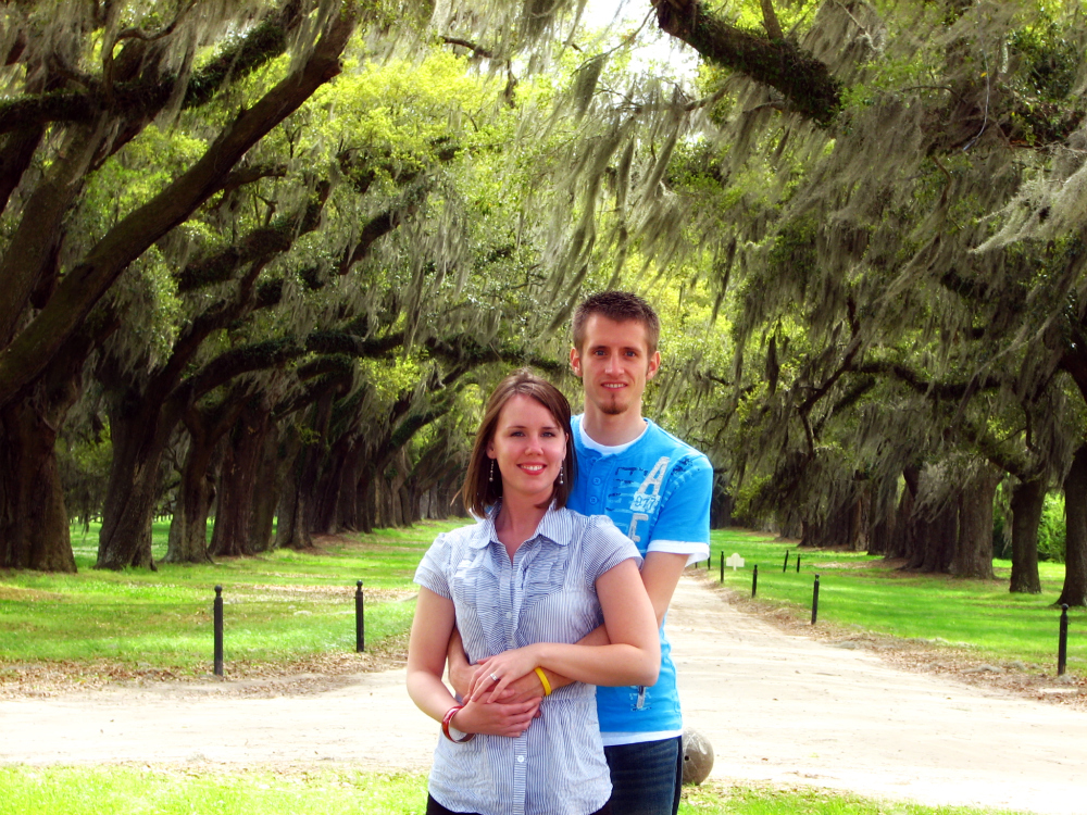
Mount Pleasant, South Carolina

WHEN: September 21, 2013
MAP IT!
MAP IT!
Mount Pleasant, South Carolina

WHEN: September 21, 2013
WHERE: Nature Adventures Outfitters
ADDRESS:Shrimp Boat Ln.
ADDRESS:Shrimp Boat Ln.
CITY: Mount Pleasant
STATE: South Carolina
LATITUDE: 32° 47' 33.60"N
LONGITUDE: 79° 52' 53.40"WMAP IT!
Asheville, North Carolina

WHEN: October 13, 2013
WHERE: Biltmore Estate
ADDRESS: 1 Lodge St.
ADDRESS: 1 Lodge St.
CITY: Asheville
STATE: South Carolina
LATITUDE: 35° 32' 25.55"N
LONGITUDE: 82° 33' 06.70"WMAP IT!


0 comments:
Post a Comment